3-steps analysis to extract accurate spatial information!
Spatial information extraction of floating objects on the sea
Overview
In general, the near-infrared band (multispectral band) has
worse spatial resolution than the panchromatic band, so its data
volume is smaller. In the future, artificial satellites will be able to
take images of almost the entire Earth once a day, accumulating
a huge amount of data. Analyzing all of these images will
require an enormous time and an improvement of computer
performance.
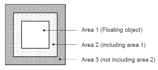
This invention is about a method which reduces the analysis
time and computer processing power by identifying area 1
where objects are floating on sea using the near-infrared band
with low data volume, then making object-based analysis by
creating panchromatic band images of the neighborhood area 2.
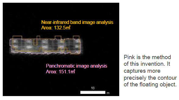
In addition, spatial information such as the floating object size,
quantity, location, etc. can be extracted with high accuracy.

Features・Outstandings

Product Application
・Safety management in ship operation
・Detection of driftage caused by floods, etc.
Related Works
[1] The Remote Sensing Society of Japan 65th academic lecture thesis collection
http://www.rssj.or.jp/act/conference/65th_autumn
IP Data
IP No. : JP2019-162614(application), JP2021-43485(publication)
Inventor : MURATA Hiroki, YONEZAWA Chinatsu, KOMATSU Teruhisa
keyword : Software
